Category Archives: Irish Countryside

Postcards from Mount Congreve, Waterford, one of the great gardens of the world

The gardens at Mount Congreve, Waterford, consist of around seventy acres of intensively planted woodland garden and a four-acre walled garden. The owner, the late Mr Ambrose Congreve, was inspired by Mr Lionel de Rothschild’s exceptional garden at Exbury in Hampshire, England.

It was here that he indulged his passion for Rhododendrons, Magnolias, Camellias and indeed many other plants from every continent in the world.

With over 3,000 different trees and shrubs, more than 2,000 Rhododendrons, 600 Camellias, 300 Acer cultivars, 600 conifers, 250 climbers, hundreds of magnolias, hundreds of wisteria and countless herbaceous plants, this is a truly magnificent site and what is more, these wonderful gardens were gifted to the people of Ireland after the death of Mr Congreve.

My Blogging friend, Social Bridge lives in this area and has long tempted me to come to have a look….and what a magnificent look it was! My most excellent guide knows every inch of the place and she was the best company on my visit!

I am posting these images ‘as they come’ so you too can take a virtual walk and enjoy this magnificent place.

My wonderful guide!

My wonderful, knowledgeable and inspirational guide!

Mount Congreve is open to the public Thursday – Sunday from 11 am.  I heartily recommend a visit and I am looking forward to seeing the herbaceous summer borders in all their splendour. Oh and the cafe is just lovely!

For further information http://www.mountcongreve.com

12 Comments

Filed under Great Gardens, Ireland, Ireland Seasons, Irish Countryside

Postcards from Newtownforbes Co. Longford

Newtonwforbes in County Longford  is a small village located  just a few miles outside Longford town, on the busy N4 Dublin to Sligo road.  Originally known as Lisbrack (Lios Breac in Irish), the name was changed to Newtownforbes in the middle of the 18th Century by the Forbes family, who were granted the lands here in the early 1600s. The Forbes family, with the title Earls of Granard, have lived in the village for over 300 years.


The present Castle was constructed in the 19th Century – the original built c.1624  was destroyed by fire. As this is a family home, the entire demesne is private and not open to the public.

Eastern_Grey_Squirrel

Introduced Grey Squirrel (Image Wikipedia)

In 1911, the grey squirrel was introduced here. An indigenous species of North America, several pairs were given as a wedding gift to a member of the Forbes family in 1911. A number escaped and went on to breed prolifically and almost annihilate the native Irish red squirrel. Fortunately the progress of the grey squirrel seems to have finally been halted in recent years, and the red squirrel is again increasing in numbers.

The main street in Newtownforbes has remained largely unchanged over the decades with modern development confined largely to side streets.  Two churches dominate the village, both provided by the Forbes family.  The Church of Ireland church of St. Paul, built  about 1820, replaced an earlier church from 1694.  The graveyard here has been mapped and recorded by a local team of dedicated volunteers lead by Doreen McHugh and Des Mooney. The earliest recorded burial dates to 1698.  The results of their work can be seen on the Historic Graves website. See the link below.


There is a Forbes family crypt in this churchyard and interestingly, and unusually I would think, there is another Forbes family mausoleum attached to the  Roman Catholic Church of St. Mary’s.


The Catholic Church of St Mary’s, where I was baptized, is in the centre of the village. This is the parish church of Clonguish. It has been almost totally remodelled in recent times.

IMG_5368

Clonguish RC parish Church

However, it used to look like this:

Original RC Clonguish Parish church in Newtownforbes. (Image retrieved from NLI at  http://catalogue.nli.ie/Record/vtls000330897)

The ‘explanation’ for this dramatic change appears on this plaque at the side of the church. It would appear that the term ‘restoration’ can have a very broad meaning!

Plaque marking the 1974 work on the RC Church in Newtownforbes.

Either side of the main entrance door are two carved heads, which may or may not represent specific people. These are part of the original church, built 1861-1864.


I had hoped that some of the interior survived the renewal, in particular the baptismal font at which I was christened, but I was to be disappointed.  With the possible exception of the brass sanctuary lamp, some stained glass windows and the mosaic memorial to the local nobility, everything else seems to be modern.


The new round stained glass window is very attractive and compliments the interior. The original side aisles have been removed and everything within seems to be very modern.


Returning to this little village in the midlands of Ireland is always poignant. The Station House, in which we were born and where we spent many happy times with our grandparents, was built in the 1860s and closed as a railway station in 1963 . It is now a beautifully maintained private residence. It is always nice to stand on the little bridge and look down to the place where we made many happy memories.

IMG_2387

Newtownforbes Station House, where our grandparents lived

The railway line is still in use. I have lovely memories of walking along the line with my grandfather. The main telephone lines ran on poles along the line in those days. and he used to lift me up and place my ear against the poles to hear them ‘singing’.

IMG_2389

The Dublin – Sligo line is still in use although the station is closed.

It was always exciting to cross over this little bridge as we knew we had arrived for more adventures!

IMG_2385

The railway bridge at Newtownforbes Station

Quite near the Station is the abandoned Lisbrack House. Most recently a nursing home, it was once a school and a bishop’s home. To the best of my recollection our mother was taught to play the piano in this building by a very cranky nun who was also a great pianist!

IMG_2394

Former Lisbrack House

Another prominent religious site on the main street is the Convent of the Sisters of Mercy. About 1869 the nuns were invited here by the Earl of Granard who provided the site for the buildings to enable them to educate the children of the estate. An orphanage and industrial school were also established here.  Sadly this site had a role in the tragic legacy of such establishments in Ireland. The school and convent are now closed and I understand that these rather nice buildings are now apartments.


The village has many buildings from the 19th and early 20th centuries. The two storey tudor style house is one of a pair provided for estate workers and it was in these that County Longford’s first flushing toilets were installed.

IMG_2328

A Tudor style house built for estate workers – among the first in the county to have flushing toilets!

Many  of the houses would would have originally been thatched and unfortunately many are no longer occupied.


The former RIC Barracks built c. 1900 was burned during the War of Independence. It was later rebuilt for the use of the Garda Siochana (Irish Police) and is now a private residence.

IMG_2345

The former Newtownforbes RIC Station

This interesting item is the Famine Pump. It was provided by Lord Granard as a Famine Relief scheme. It sits alongside a building that started life as a shooting range in Longford army barracks.  It was purchased by a local who erected here c.1933 and is known locally as Christy’s Hall.

IMG_2341

Famine Water Pump and Christy’s Hall

The hard work of the local tidy towns volunteers is evident throughout the village.


And local junior artists have also been decorating the hoarding surrounding the former school buildings.


A board inside the church lists the townlands in the parish of Clonguish, which derives from the Irish ‘Cluain Geis’ which means The Meadow of the Swans.

IMG_5367

Newtownforbes is the last resting place of our grandparents and an uncle and aunt so visits nowadays are to pay respects at their graves in the new cemetery.


One of the great delights of my brief visit discovering a great little restaurant  called Tús Nua right on the main street, so if you happen to be passing through, drop in for a wee wander through this quaint little village and enjoy a fabulous coffee in this delightful coffee house!

IMG_2396

References

http://historicgraves.com/graveyard/newtown-forbes/ld-spnf

http://http://catalogue.nli.ie/Record/vtls000317412

Home


10 Comments

Filed under Ireland, Ireland and the World, Irish Countryside, Irish Heritage, Irish History

Postcards from a special Kilmacrennan tea house!

Every once in a while you stumble on a little treasure of a place and want to tell the world! Such was our experience last Sunday afternoon in the village of Kilmacrennan in North Donegal, Ireland.

 On a day filled with torrential downpours we were in need of some comforting food, and so we stopped at the very pretty group of thatched cottages on the Creeslough end of the village. This group of little thatched buildings have been in Kilmacrennan for some 150 years and previously housed a museum.

They are now under the management of a young couple who have exciting plans for these lovely buildings.

If you fancy a B &B in an authentic thatched Irish cottage, this is the place for you! This beautiful cottage is available to rent on Air B and B.

The former little dairy will be used for workshops.

The largest building houses a tea and coffee shop, and when you step inside you know you have arrived somewhere special! It’s not just a matter of tea or coffee, it’s so much more! Wonderful food, wonderful atmosphere and a warm welcome await!


The light lunch we enjoyed was very special with artisan breads and very creative choices of savoury and sweet options served in beautiful surroundings.

The centre piece is of course the open fire with a blazing turf fire and a crane with a selection of cooking pots that were used in times gone by.


We were just a little too early for the music sessions that happens here on a Sunday afternoon but there was a lovely atmosphere even without it! 

It’s great to see new ventures and people thinking outside to box to provide unique high quality services to locals and visitors alike. I heartily recommend a visit to this lovely place, for either breakfast, lunch or a coffee break …you will not be disappointed! 


A gem of a place! 

Coffee Time Cafe Facebook page is at https://www.facebook.com/tiscoffeetime/

Twitter account is @tiscoffeetime

7 Comments

Filed under Irish Cooking, Irish Countryside, Irish Heritage

Postcards from Ballybeg Priory, Buttevant, Co Cork

img_4885For years I  have been travelling the torturous route between Limerick and Cork, the N20, surely one of Ireland’s worst major routes with single file traffic wending its way along through towns and villages, with serious sharp bends to be negotiated.

Perched alongside this road, on the Cork side of the town of Buttevant is the fantastic Ballybeg Priory. As many motorist do, I have been taking side glances at this ruin for decades as it is far too dangerous and impossible to stop on the main road.  Before you know it, you have gone past the narrow access road.  However on my last foray on the notorious N20,  I was determined to pull over to take a look at this ancient place and so I finally managed to turn off into the access laneway.

Founded in 1229 for priests who lived a monastic life, the Canons Regular of St Augustine, the Priory was laid out with buildings surrounding a central courtyard or  cloister. Two fine windows of the original church were incorporated as part of a tower some centuries later.

img_4868

Much of the site is inaccessible as there seem to be some works being undertaken by the OPW.  It’s an awful pity that they do not provide notices as to what the are doing or why sections are barricaded. Their non medieval porta-cabin does nothing to enhance the visitor experience.

img_4880

Cabins and barriers but no explnataion.

Not withstanding these 21st century intrusions, this is a very special place with a wonderful mystical atmosphere. It is sobering to think that I have walked where monks did as long ago as 800 years back.

This site also has a pigeon house, or columbarium, with roosts for about 350 birds and is considered to be the finest of its kind in all of Ireland. It was not possible to get any closer on the day of my visit.

This dove-cot provided food for the monks and also fertilizer for their farm.  An internal view of the dovecot can be seen here.

It is well worth stopping here to explore this ancient site. It’s a pity that not all of the site is accessible, but hopefully that will improve when  the OPW finish their works.

img_4888


Further reading

http://www.buttevant.ie/History/Ballybeg-Abbey.html

http://irishhistorypodcast.ie/ballybeg-priory-co-cork/


1 Comment

Filed under Ireland, Irish Countryside, Irish Culture, Irish Heritage, My Travels

Postcards from Ardagh, County Limerick – a hidden Ireland

image

Ardagh Main Street (Image thesilvervoice)

For over 35  years I lived adjacent to the small village of Ardagh in rural west County Limerick. We came here from London in 1981, back to the parish where my late husband was born and grew up. It is astonishing to think that I have lived here much longer than he did and this opens up interesting questions about where ‘home’ is. Is it where we grew up? Is it where we lived longest? Is it where we have best memories? A debate for another day, but Ardagh is the place that was ‘home’ to me for longer than anyplace else, in fact for almost half of my life!

At first sight Ardagh is a low key unremarkable place. The village has suffered from the general decline in the towns and villages of rural Ireland, having seen the closure of  general stores, petrol stations, a number of pubs and more recently, the Post Office. It is not on any tourist route, and but for GPS systems routing vehicles (and inappropriately heavy commercial traffic at that, on our twisting narrow access roads) through the village on shortcuts to and from Listowel, Limerick and Foynes, we would probably see relatively little traffic. The village street dominated by a Catholic Church, in all honesty  has little to commend it. It has a few commercial properties including a butcher shop, and a couple of pubs. It has many traces of better times, throwbacks to times of more commercial activity in the village, such as closed and abandoned public houses, a closed timber factory, and several houses with very large front windows, indicators that once upon a time shops traded from these premises. A road leads off the main street towards the local school that caters for pupils up to age 11 or 12, a school attended by my own children. The village ‘ends’ at the junction of the Main Street with the busy Newcastle West/ Foynes Road, for many years a dangerous junction that is thankfully now marked by traffic lights.

But there is more to Ardagh than the very unremarkable village street. It is in fact a shining example of a ‘Hidden Ireland’, an Ireland that has to be sought out and explored and when that surface is scratched there is real treasure to be found! The Ardagh locality has a number of historic features and a very rich late prehistoric and early medieval heritage, making it unique among the villages of Ireland.

A glance back at the 1901 and 1911 census for Ardagh reveals that not much has changed in the village over the past century. The census returns show a small number of grocers and publicans and a number of  servants, farm labourers, railway workers, coopers, blacksmiths etc such as would be found in a small rural community. The hinterland is lush farmland at the edge of the Golden Vale  which provided employment for farm and agricultural workers.

The name Ardagh is derived from the Irish word, Ardachadh, which means ‘High Field’. The Ardagh area has been inhabited for aeons, and there is evidence for such all about the place. The area has a high concentration of ‘Ringforts’, which are fortified dwellings dating back to the first millennium. There are quite noticeable Ringforts at several townlands near the village including  at The Commons in Ardagh, at Dunganville, at Rathronan and at Reerasta with their earthworks quite evident to this day.

Rathronan Ring Fort (Image thesilvervoice)

In 1981 a very large Hill Fort, covering over 50 acres and dating back possibly 3,000 years to the late bronze age, was identified during an aerial survey of the area. The climb to the top is worthwhile, and will be rewarded with stunning views of  five counties – Limerick, Clare, Tipperary, Cork and Kerry. This Hill Fort at Ballylin, known locally as The Black Hill, is one of the largest ever discovered in Ireland, yet it remains relatively unknown.

The Black Hill Hill Fort

The Black Hill Hill Fort seen from the Foynes Road.

Just across the road from our house was the Ringfort at The Commons with a beautiful view of thousands of years of heritage!

early-medieval-ringfort-with-hillfort-in-the-background

The Ringfort at The Commons, with the Hillfort at Ballylin in the background (Image Damian Shiels)

Ringforts are often associated with fairies!  My mother in law used tell tales of cattle straying into Dunganville Fort (which was near her home ) and people trying to round them up unable to find their way out again sometimes for hours on end!

There is a ‘Holy Well’ dedicated to St. Molua, the Patron Saint of the catholic parish adjacent to the graveyard in the village. St Molua died in 629. It is not really known whether or not he lived in Ardagh as there is no written evidence of any direct connection with him, and it is thought that there were dozens of St Moluas in Ireland. So which one was he? Mary Kuiry local historian is an authority on the St Molua associated with Ardagh and an interview with her can be heard here.

The ivy clad ruins of an old church in the graveyard date to about the 15th Century and it is believed that there was an earlier church on this site. According to Lewis Topographical Dictionary of Ireland the church ‘was destroyed in the insurrection of 1641, and has not been rebuilt’. Among the burials in the ruins are those of a Bishop of Limerick, Robert De Lacy.  He was made bishop by Pope Clement XII in 1737 and died on August 4th 1759.  He chose to be interred in the family vault in Ardagh rather in more sophisticated surroundings!

The present Roman Catholic church dates from 1814. I found this very surprising as both inside and out, it looks very modern. A 20th Century renovation seems to have removed every vestige of an earlier building .

The interior of the church is very pleasant and bright and visitors are welcome.

336FDFB0-5EA4-4D46-8430-BFC49F267724

Interior of the catholic church (Image thesilvervoice)

There are two other churches in the vicinity – the ruined  Church of Ireland at Kilscannel  which dates from 1822 and is interesting as there are both catholic and and protestant burials in the grounds. The oldest headstone in this graveyard dates to 1795. This church is located adjacent to a sharp bend in the road, where motorists must slow down. A local story tells of car doors mysteriously opening and closing again at this spot, souls apparently getting a lift to someplace. Of course you do not believe these tall tales, but you cannot help but wonder when you pass by late at night!

The other church is the Kilronan Church of Ireland and is also in ruins. Dating from 1820, this little church is accessible by means of a narrow lane. I find that there is something very serene and magical about it. Attached is a small graveyard with about 40 or fifty headstones and two mausoleums.

0EC85B26-D26B-484C-970E-A59E8C97FBCB

Rathronan Church of Ireland in ruins (Image thesilvervoice).

I was fortunate enough to get to see inside this church a few years ago. It has some nice windows and the pulpit stands abandoned.

This beautiful spot is the final resting place of William Smith O’Brien, Irish Nationalist, Member of Parliament and leader of the Young Ireland Movement. See an earlier post about him here.

The road to the little graveyard where Smith O’Brien rests is accessed from the Foynes road.

His family worshiped at this church as they lived nearby in Cahermoyle House. He died in 1864. His funeral was attended by crowds of people who lined the route between his home and the graveyard. It is fascinating to walk up the quiet narrow laneway in the footsteps of such a famous funeral cortege.  This site is of national importance because of his sacrifice for the people of Ireland and really deserves to be better known as indeed does this beautiful site.

Just three years after the death of William Smith O’Brien, on March 5 1867, about 40 men attacked the police barracks in Ardagh. This was part of a general national rebellion against British Rule in Ireland, organized by the Irish Republican Brotherhood, and known as the Fenian Rising. I think Smith O’Brien would have been proud that the small village near his home put up such a show of strength with their pikes and muskets marching on the police barracks! The insurrection was unsuccessful, due mainly to lack of planning and coordination, but nevertheless it set the scene for the 1916 rising in Ireland.

img_5172

One year later again, Ardagh was back in the news. This time it was because of the discovery of one of the most wonderful treasures ever found in Ireland!

77546A49-F0E7-4725-B23C-B546F689DD31

While digging potatoes in a field at Reerasta Ringfort, two local men, Jimmy Quin and Paddy Flanagan, unearthed the treasure. This hoard of magnificent objects included the very distinctive 8th Century Ardagh Chalice, fashioned from silver, bronze and gold. The chalice and the rest of the hoard are in the National Museum of Ireland where they have pride of place. The Sam Maguire Cup, awarded to winners of the All-Ireland Senior Football Championship, is modelled on the Ardagh Chalice. Our home was for many years the only house in Reerasta South in modern times, a fact that filled us with pride. Our site was at the edge of the farm on which the Ardagh Hoard was discovered.

There is a very nice new monument in the grounds of the Catholic church in Ardagh marking the discovery of the hoard in the parish. It would be wonderful if there were some decent replicas in the village as it would certainly be a tourist attraction for the thousands of tourists who pass within a few miles of it on their way to Kerry!

37-DSCF6500

The very attractive commemorative monument, with carved representations of the Ardagh Hoard.

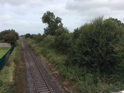
The Great Southern Trail, an off-road walking and cycling greenway passes through by the disused Ardagh Railway station. For delightful traffic free walks and spins in all seasons this amazing amenity is  second to none and in my opinion is one of the highlights of West Limerick.

Located in a beautiful part of West Limerick, with lovely views across the rich farmland, Ardagh deserves to be ‘on the map’ and explored and is a perfect day tripper destination.

You will be very welcome!

28-IMG_4748

Ardagh  Signage

*I am much obliged to Skyview Photography for permission to use the wonderful aerial footage  of the village. See more awesome footage and images at their website http://skyviewphotography.ie/

Further information.

http://www.southerntrail.net/

Welcome

Skyview Photography – Drone Aerial Photography

Click to access 4361921.pdf

AmbroseRobert

12 Comments

Filed under Ireland, Irish Countryside, Irish Culture, Irish Heritage

Discovering landmarks and Family History on Blacksod Bay, County Mayo

Continuing along Ireland’s Wild Atlantic Way, rain and low grey cloud were my only companions as I headed into this remote Irish-speaking part of County Mayo. Although visibility was reduced it was still possible to enjoy some lovely sights. The Irish-only road signs were something of a challenge at first, even though I am used to our bilingual signs here in Ireland and Irish-only signs in Donegal, and other Gaeltacht areas, these places were not familiar to me. However, once I figured out that ‘An Fod Dubh’ meant ‘Blacksod’ and that therefore ‘Chuan and Fhóid Duibh’ was Blacksod Bay, I chugged along happily in the beautiful Mullet Peninsula that protects Blacksod Bay from the worst of the Atlantic weather.

img_7597

Trá Oilí or Elly Beach

This eye catching beach is one of many big sandy beaches in the area. It sports the Blue Flag, one of the world’s most recognised eco-labels, indicating that it complies with a specific set of criteria on water quality, information points, environmental education, safety and beach management. Raining or not, this is a good beach for swimming!

Tír Sáile – the North Mayo Sculpture Trail –is the largest public arts project ever undertaken in Ireland.  Several of these sites are located here on the Mullet peninsula. This work is entitled ‘Deirbhile’s Twist’ and I like that it was formed by raising large granite boulders already lying around on the ground and arranging them into an eye catching feature. This is located at Falmore which is a beautiful location, even in the mist!

Saint Deirbhile (Dervilla) is a local saint who arrived at Falmore in the 6th Century. Arriving by donkey she was pursued by an unwanted suitor who,so the story goes, was very attracted to her beautiful eyes. Rather drastically she plucked them out to discourage him and he left, heartbroken. Water gushed from the spot where her eyes fell and after bathing her sockets her sight was restored. The ruins of her convent are here near the seashore with Deirbhile’s Well nearby. Modern day pilgrims believe that water from the well can help cure eye complaints and they come here for special devotion on August 15 each year.

Ruins of Dervilla's Monastery

Ruins of Dervilla’s Convent

And then on to the site I was particularly interested in – Blacksod weather station, situated at the end of the peninsula.

This is Blacksod Lighthouse, looking very unlike a traditional lighthouse, perched atop an old granite building that dates from 1864. This is a very significant place because it was from here that a weather report issued on 3rd June 1944 changed the course of history. The World War 2 D-Day landings scheduled for June 5th were delayed because of the hourly weather report lodged by Irish Coast Guardsman and lighthouse keeper Ted Sweeney, which indicated that there would be adverse conditions in the English Channel for the following few days. Blacksod was of particular significance because it was the first land-based observation station in Europe where weather readings could be professionally taken on the prevailing European Atlantic westerly weather systems. Ted’s report on June 3rd mentioned a rapidly falling barometer and strong winds which would have augured badly for the planned invasion. A further report from Ted at 12pm on June 4, said ‘heavy rain and drizzle cleared, cloud at 900 feet and visibility on land and sea very clear’. This meant that better weather was on the way for the south of England, and so Operation Overlord went ahead on June 6th 1944 with calm clear conditions in the English Channel.

img_0938

Plaque at Blacksod Lighthouse

There is a nice little harbour alongside the lighthouse, Termon Pier, which was almost totally deserted when I was there with only rain and wind to be heard and seen and a few currachs pulled up out of the water.

Winds were picking up the rain was relentless so it was time to leave. I was delighted that I had made the trip out here and discovered a few sights, in spite of the conditions.  Suddenly there was an incredible noise that almost deafened me and for the life of me I could not figure out what on earth it was.  On turning round I saw a helicopter had just taken off from right beside me, as  there is a Helicopter Landing base beside the Lighthouse!

A helicopter lifts off

A helicopter lifts off.

I left here very pleased with my foray into this area, and with the few treasures I had discovered. However, the Mullet Peninsula had one more surprise in store as not far along the road I  came upon Ionad Naomh Deirbhile, a local Visitor and Heritage Centre.

img_1292Although they were about to close I was invited in for tea and a homemade scone and here discovered the story of The Tuke Fund assisted emigrants. It is not always recognized that hunger in Ireland did not end with the famines of 1845- 1852 and 1879. Hunger and deprivation were a fact of life in poorer districts of the western seaboard in particular, with hundreds of families needing relief into the mid 1880s and beyond. James Hack Tuke (1819-1896) was an English Quaker who made it his mission to aid people suffering from starvation and deprivation in the West of Ireland. One of the features of the Tuke Fund assisted migration was that only entire families would be facilitated, thereby freeing up smallholdings for another family. The emigrants were provided with the fare and money to enable them settle in their new locations.  In 1883 and 1884, 3,300 emigrants left North West Mayo and Achill, boarding ships in Blacksod Bay.  They sailed on 10 separate voyages, for Boston and Quebec. There are impressive storyboards at the centre, where descendants of those who left here almost 140 years ago are welcomed. One such family arrived while I was there. It is reckoned that over 2 million people are descended from these North Mayo emigrants

The research on the Blacksod Tuke Emigration scheme was carried out by Rosemarie Geraghty, I believe for her thesis. Rosemarie has researched the 10 ships manifests that carried these families to their new lives in what she describes as the time of the  ‘forgotten famine’  and is absolutely delighted when descendants arrive here in search of their roots. I asked her what the charges are for family research and she said ‘They left here with nothing, we are never going to charge them to know where they came from.’ Rosemarie is ably assisted by Norah Cawley, a superb scone maker who makes visitors feel very welcome indeed. I have been to many a family research centre before, but never one like this – with such enthusiasm, warmth,  passion  and great scone making!

All of this information with family names  is available free to view, and is searchable under various headings, at http://www.blacksodbayemigration.ie . They just love to hear from anyone wherever in the world whose ancestors may have left this beautiful place over 130 years ago.

On what was a miserable wet grey cloudy day, how lucky was I to discover such wonderful silver linings at the Mullet Peninsula and on the shores of Blacksod Bay!  More treasures of the Wild Atlantic Way – Beidh mé arais arís!


St Deirbhile Stained Glass window at the Centre.

St Deirbhile Stained Glass window at the Centre.

References

http://www.independent.ie/irish-news/how-blacksod-lighthouse-changed-the-course-of-the-second-world-war-30319681.html

http://www.blacksodbayemigration.ie/

http://www.museumsofmayo.com/deirbhile.htm


12 Comments

Filed under Emigration from Ireland, Family History, Ireland, Ireland and the World, Irish Countryside, Irish Diaspora, Irish History, Mayo Emigrants

Seamus Heaney’s Flaggy Shore

image Seamus Heaney was one of Ireland’s best loved poets. His death came suddenly on August 30, 2013, leaving an entire nation bereaved. While his work and his words live on in bookshelves and on bedside tables across the land, he is greatly missed. He had such a way with words and such a mellow speaking voice that I for one could listen to him all day long.
imageOn my recent trip along the Wild Atlantic Way I happened upon The Flaggy Shore in County Clare on the shores of Galway Bay. So here in front of me was a seascape that inspired this great man. On a grey day the leaden sky hung over a silvery sea lapping a silvery grey shore. I could not help but wonder how such a scene could inspire anyone!  And therein is his greatness. I recall reading that Heaney said of his poem about the Flaggy Shore ‘we drove on into this glorious exultation of air and sea and swans.’ The swans were not on the lake beside the shore on the day of my visit but there certainly was an abundance of air and sea!

Perhaps it takes a man of Heaney’s caliber and talent to see such beauty in what could be considered a relatively mundane landscape! Many know of this poem as ‘The Flaggy Shore’ but the correct title is ‘Postscript’.

image

Postscript

And some time make the time to drive out west

Into County Clare, along the Flaggy Shore,
In September or October, when the wind
And the light are working off each other
So that the ocean on one side is wild
With foam and glitter, and inland among stones
The surface of a slate-grey lake is lit
By the earthed lightening of flock of swans,
Their feathers roughed and ruffling, white on white

Their fully-grown headstrong-looking heads
Tucked or cresting or busy underwater.
Useless to think you’ll park or capture it

More thoroughly. You are neither here nor there,
A hurry through which known and strange things pass
As big soft buffetings come at the car sideways
And catch the heart off guard and blow it open. – Seamus Heaney
image

Seamus Heaney, poet, playwright, translator and lecturer, and the recipient of the 1995 Nobel Prize in Literature passed by this Flaggy Shore before me. I am so glad he did. He died three years ago. His legacy lives on.

10 Comments

Filed under Ireland, Ireland and the World, Irish Countryside, Irish Culture, Poetry

The Céide Fields: The World’s oldest known field system

A Pine tree that lived in Mayo 4,300 years ago

A Pine tree that grew in Mayo 4,300 years ago and lay preserved in bogland.

In Ireland we have an annual celebration of our Heritage during National Heritage Week, part of the European-wide ‘European Heritage Days’, that promote every aspect of our wonderful, varied heritage. During this week there are hundreds of events showcasing the richness that we have inherited in our natural surroundings, our landscape our buildings and in our literature, history legends, and culture. This is an excellent time to make new discoveries and to revisit favourite places.

This year I will mark Heritage Week by recalling my visit just a few weeks ago to one of the most unique landscapes anywhere in the world that is to be found in North County Mayo, along Ireland’s Wild Atlantic Way. This place is called The Céide Fields, (pronounced Kay-Ja), a one thousand hectare monument that is the world’s largest dated Stone Age or Neolithic site. 5,500 years ago, a farming community lived, loved and worked here, raised their children, reared cattle, made pottery, grew crops, built homes, made gardens and buried their dead.

Blanket bog protects the site

At first sight, there appears to be very little here on this barren landscape –  all the more bleak on the morning of my visit with strong wind and driving rain! The land that stretches up over the hill seems to be flat and featureless, and will be recognized by Irish people as ‘just bog’. Bog is an emotive type of wetland landscape here in Ireland.  For centuries peat bog has provided fuel for our homes  and in recent times efforts to conserve some of this type of endangered habitat have become politically charged and confrontational. But here near Ballycastle in Mayo, this very landscape has protected a way of life for thousands of years, covering features of times past with metre after metre of protective vegetation.

In Ireland we have two types of peat bogland covering 1/6th of our land mass – smaller scale ‘Raised bogs’ which are the subject of conservation restrictions, and the more ubiquitous ‘blanket bogs’ found in much of the West of Ireland and here at the Céide Fields. These wetlands have evolved over aeons as can be seen in the diagram below demonstrating the evolution of blanket bog from the past, when the land was farmed; bog formed and enveloped the area; then peat removal for fuel resulted in the ground being used for growing again.

image

Peat is formed from dead plants that have not fully decomposed due to the lack of oxygen in very wet soil. Sphagnum which has water retention properties is a key component of bogland as it keeps oxygen levels low and steadily the dead plant matter of the sphagnum accumulates. The bog can grow to many metres in depth as the vegetation keeps building up. Here at the Céide Fields, the blanket bog covered over the remnants of the prehistoric farms to a considerable depth, smothering trees and other vegetation that once grew there.

The bog covered and concealed evidence of early life.

The bog covered, concealed and protected evidence of early life

In this representation of a turf bank below, it can be seen that over the centuries the depth of the bog increase. Today where is 1.5 metres high; 2,000 years ago, at the time of Christ, it was 0.9 metres high; 4,000 years ago at the time of the Egyptian pyramids it was 0.3 metres deep and a thousand years earlier people lived and worked in this fertile area.

A model of a turf bank showing evidence of turf cutting

A model of a turf bank showing evidence of turf cutting

This remarkable landscape was first noticed by a local man in the 1930s when he was cutting turf for his home fire. He noticed piles of stones as he cut deeper into the turfbank and felt that they were so orderly that they must have been placed there deliberately by humans. Years later his son, Séamus Caulfield an archaeologist, conducted  an investigation and discovered the series of walls, houses and tombs deep below the bog. The site has now been extensively explored and excavated to a limited degree, enough to show that the community of farmers who lived here 200 generations ago had reclaimed their ground by clearing vast expanses of pine forest. Seeds and pollen found at the site have been identified and dated and this with other dating methods has enabled scientists to determine the age of the site, the type of crops grown and the implements used.

Reconstruction of a plough used by these ancient farmers

Reconstruction of a plough used by these ancient farmers

There is a splendid award winning interpretive centre here, with guided walks available. There is a wealth of flora and fauna at this site unique to the habitat.  Unfortunately on the day of my visit inclement weather prevented such exploration, but by studying  the excellent exhibits I was able to et a great understanding of the treasure that is here.

Céide Fields Award Winning Interpretive Centre

Céide Fields Award Winning Interpretive Centre

The centre has a viewing platform that on better days than this, affords fabulous 360 degree views of the entire area.

The steps to the viewing platforms.

The steps to the viewing platforms.

In spite of the inclement weather I did venture outside on to the viewing area and was very happy to have a rail to hang on to in the very blustery wind and driving rain!


Steps leading to the Heart of the Céide Fields.

Steps leading to the heart of the Céide Fields, from where the guided tours begin.

It was a real thrill to finally visit this incredible site with an extraordinary and unique history. Irish Heritage at its best!


References

http://www.heritageweek.ie

Irish Peatland Conservation Council. http://www.ipcc.ie/

The graphic on the evolution of bogland is from the website http://www.irelandstory.com, which at time of writing is no longer available.

Céide Fields


8 Comments

Filed under Ireland, Irish Countryside, Irish Heritage

Land of my fathers.

I came across this fabulous aerial video today on Facebook. As a rule, I post only my own work on this blog but I must make an exception with this fabulous video. This footage is the work of  photographer Pat Ward and it was filmed along what was known as the Gweebarra Bends. The Gweebarra River meets the sea here in Donegal. The view from the home of our paternal great-grandparents is of this estuary. The video shows Kilkenny National School where our grandfather was a Monitor before entering St Patrick’s Teacher Training College in Drumcondra in Dublin in 1917. Just a short distance away on the same side and behind where a new house now stands was their small cottage. Our great-uncle John used walk from the house in Mulnamina across the Gweebarra Bridge to Sunday Mass in the chapel in Leitir (Lettermacaward) which is glimpsed later in the video.

The Gweebarra Bends, now about to disappear as the road is straightened, were enjoyed by us as we drove along to visit the house when we were children. Loaded into the back of the car, our father used get us to lean in the direction of the bends to help the car get around the corkscrews! Then we would all have to lean forward as we made our way up the hill to the bottom of the lane where we would pile out and run the last few hundred yards to see where the badgers hid, to pet Uncle John’s white donkey and to pick white heather high up on the hill behind the small house and then enjoy some of  Aunt Maggie’s delicious skillet bread baked on the open fire. Such beautiful memories and such a beautiful video. Thank you Pat Ward!

This I am sure you will agree is a most beautiful video….enjoy!

2 Comments

Filed under Family History, Ireland, Irish Countryside, Irish Heritage

Postcards from the Wild Atlantic Way:Easkey County Sligo

Continue reading

1 Comment

Filed under Ireland, Irish Countryside, Irish Culture, Irish Heritage, Irish History